India Draws The Line : Bharat Counters China’s Cartographic Aggression In Arunachal Pradesh
From repeated renaming exercises to frontier villages, Beijing"s claim over Arunachal Pradesh now faces a more explicit Indian response
Total Views |



On 7 August 2026, India, in consultation with Arunachal Pradesh, formally identified 27 places and geographical features by standard names on Survey of India maps, improving recognition amid China’s repeated renaming exercises across the state.
India’s Cartographic Counter : 27 Places Enter the Official Map
The Ministry of Home Affairs said the exercise was carried out with the Arunachal Pradesh government and was intended to facilitate accurate recognition and greater public awareness. The official list contains 21 land areas, four passes, one lake and one monument.
The places are Longju, Maja, Bisa, Bara Kundun, Chhota Kundun, Dhan Bari, Pritnagar, Buddhamandir, Jairampur, Teritnagar, Ramnagar, Jaswant Garh, Sagar, Padma, Jyotinagar, Baisakhi, Chhota Ropuk, Bara Ropuk, Shivaji Nagar, Sunpura and Kamlang Nagar. The four passes are Dzo La, Riza La, Pukur La and Thag La; Sambho Sarovar is listed as a lake and Sher-e-Thapa Memorial as a monument.
China’s Multi-Front Strategy : Claims, Names and Border Settlements
China claims approximately 90,000 square kilometres of Indian territory in the eastern sector, covering Arunachal Pradesh, which Beijing refers to as “Zangnan” or “South Tibet.” India rejects this claim and maintains that Arunachal Pradesh is an integral and inalienable part of India.
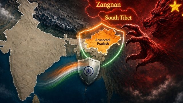
Renaming has become a recurring feature of that dispute. China issued names for six places in 2017, followed by 15 places in 2021 and 11 in 2023. In 2024, it published names for about 30 more locations, followed by another exercise in 2025 and fresh “fictitious names” rejected by India in April 2026.
The pattern matters because cartography and official nomenclature are instruments of state communication. Beijing’s repeated publication of names does not change sovereignty or administration, but it continually restates China’s claim. India’s Ministry of External Affairs has repeatedly said that invented names cannot alter the reality that Arunachal Pradesh is part of India.
India Answers with Maps and Presence
India’s August 2026 map exercise should therefore be understood precisely: New Delhi has not “renamed” Arunachal Pradesh. It has formally identified 27 places and features using standard names on Survey of India maps, creating a clearer official reference for public recognition. That distinction is important because it keeps the Indian action anchored in its existing administration rather than mirroring China’s territorial claim.
Some of the newly listed locations also carry historical significance. Longju was associated with an armed India-China border clash in 1959, before the 1962 China war. Thag La became one of the critical flashpoints preceding major fighting in the eastern sector in 1962. Their appearance on the updated official map links present-day cartography with a frontier that has remained strategically sensitive for decades.
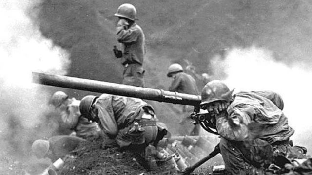
China has simultaneously expanded settlement and infrastructure programmes across the Tibet Autonomous Region. Its Xiaokang, or “well-off,” border-village programme has produced hundreds of settlements along frontier areas, including sectors opposite India. Security analysts have examined some of these villages for possible dual-use functions because roads, communications and permanent civilian presence can also support border logistics.
China’s Land Borders Law, adopted in October 2021 and effective from 1 January 2022, strengthened the legal framework for frontier management. The law addresses border protection while also promoting infrastructure, public services and economic and social development in border areas. India formally expressed concern that the legislation could affect existing bilateral border-management arrangements.
India’s Response on the Ground
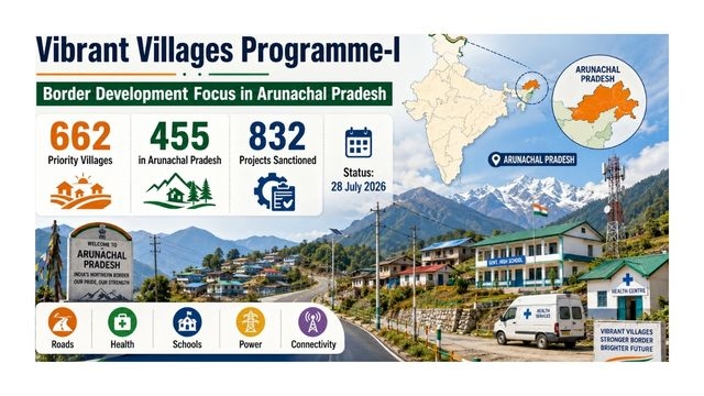
India’s Vibrant Villages Programme under phase-I, focuses on comprehensive development of settlements along its northern border. As of 28 July 2026, 455 of the programme’s 662 priority villages were in Arunachal Pradesh. The MHA said 832 projects had been sanctioned in the state, alongside road, health, school, power and connectivity initiatives across the programme.
Strategic connectivity has also improved. The Border Roads Organisation’s Sela Tunnel, dedicated in 2024, was constructed at about 13,000 feet on the Tezpur-Tawang route. It provides all-weather connectivity to Tawang and, according to the government, strengthens both armed-forces preparedness and socio-economic development in the border region.
Arunachal Pradesh also carries major energy significance. Government assessments have placed the state’s identified large and medium hydropower potential at roughly 50,000 MW. Major projects in the Brahmaputra basin, including those on the Subansiri and other tributaries, make infrastructure development in the state economically as well as strategically important.
The Normalisation Contest
China’s repeated use of “Zangnan,” publication of new geographical names and construction of border settlements are documented elements of its long-running territorial position. India’s response is increasingly visible through diplomatic rejection, official cartography, border infrastructure and development programmes designed to sustain inhabited and connected frontier communities.
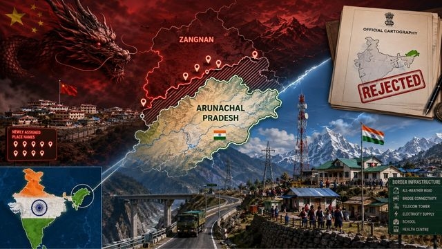
The new Survey of India identification does not settle the India-China boundary dispute, nor does it alter the military situation along the frontier. Its significance is administrative and cartographic: India is placing standard names for identifiable places and features on its official map while reinforcing physical connectivity and governance in the same border state.
The contest over Arunachal Pradesh is not fought through maps alone. China continues to press its territorial claim through nomenclature, diplomacy and frontier development, while India rejects that claim and strengthens its own mapping, infrastructure and village presence. The 27 officially identified locations are therefore best understood as one part of a broader strategy: clearer cartography backed by administration and sustained presence on the ground.
Written by

Kewali Kabir Jain
Journalism Student, Makhanlal Chaturvedi National University of Journalism and Communication